Sausalito offers a unique blend of steep hillside architecture and flat waterfront living along the San Francisco Bay. Buyers looking at Marin County real estate often gravitate toward this coastal enclave for its distinct microclimates and immediate proximity to the Golden Gate Bridge. Navigating the local housing market requires understanding how elevation and lot size dictate property values across different zip codes.
The 2026 housing landscape here remains highly competitive due to strict geographical constraints that prevent new sprawling developments. Purchasing a home in this market means choosing between historic Victorian estates, modern ridge-line properties, or even floating houseboat communities.
Overview of the Sausalito Real Estate Market
The Sausalito housing market consistently ranks among the most premium sectors in Marin County. Current 2026 median home prices range from approximately $1,290,000 for smaller inland properties to well over $3,300,000 for luxury estates with unobstructed water views. Inventory remains exceptionally tight this year, which drives fierce competition for updated single-family homes near the waterfront.
Understanding local holding costs is a crucial step for any buyer entering this market. The baseline property tax rate in Sausalito sits around 1.19%, though special county assessments can push the effective rate up to 1.39%. The clear takeaway for buyers is to budget for these effective tax rates early, especially when bidding on high-valuation properties along the eastern slopes.
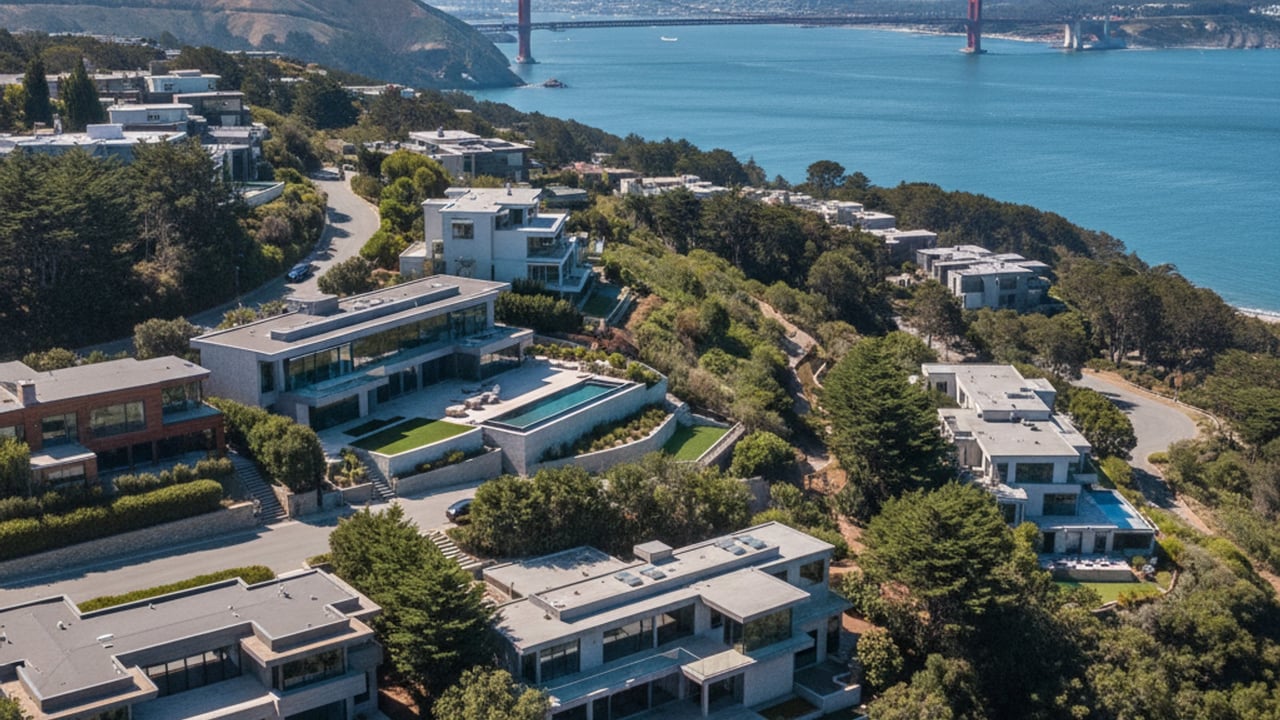
Exploring the Best Neighborhoods in Sausalito, CA
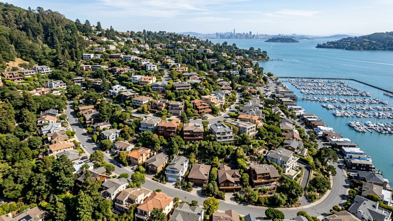
The residential landscape of Sausalito is defined by its dramatic topography, transitioning sharply from sea level to steep ridges. Property values heavily depend on elevation, architectural style, and the usability of the lot itself. Buyers will find that homes perched high on the ridges command a premium for their sightlines, while valley properties offer the rare commodity of flat, usable yard space.
Moving through the city reveals distinct enclaves, each with its own zoning rules and architectural character. Exploring these specific areas helps buyers pinpoint exactly which micro-market aligns with their specific housing requirements.
Old Town & Hurricane Gulch
Old Town and Hurricane Gulch feature steep hillside topography that heavily dictates property footprints and street access. The architectural style here leans heavily toward historic Victorian and Craftsman single-family homes built directly into the inclines. Lot sizes tend to be smaller and more densely plotted than in the northern neighborhoods.
The Hurricane Gulch area earns its name from the afternoon winds that sweep in off the Pacific Ocean. Buyers looking here must be comfortable with narrow, winding roads in exchange for classic architectural charm.
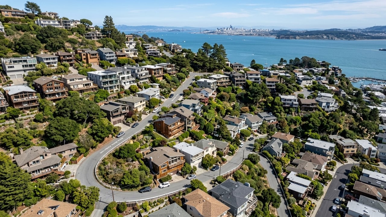
The Hill
The Hill is defined by steep, winding streets and luxury single-family homes that dominate the high-elevation landscape. Many properties here maximize their square footage through multi-story, hillside construction techniques designed to optimize sightlines. These homes frequently offer sweeping, panoramic views of the San Francisco Bay, Alcatraz, and Angel Island.
While lot sizes vary significantly, the steep grade means most outdoor space is composed of tiered decks rather than flat lawns. The premium paid in this neighborhood is directly tied to the expansive eastern exposure over the water.
Spring Street Valley & New Town
Spring Street Valley and New Town offer a stark contrast to the hillside neighborhoods due to their flatter, more accessible terrain. The architectural mix is highly diverse, blending mid-century modern designs with traditional single-family homes. Lot sizes are generally larger here, offering more traditional yard space than the dense plotting found in Old Town.
Residents in these areas benefit from immediate proximity to the Caledonia Street commercial zone. This provides easy access to local shopping, cafes, and daily amenities without needing to navigate steep gradients.
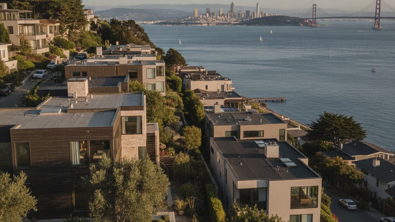
Wolfback Ridge
Wolfback Ridge is an exclusive, high-elevation enclave separated from the downtown density of Sausalito. This area is characterized by massive lot sizes and expansive modern or contemporary architectural estates. The properties here command some of the highest valuations in CA due to their unparalleled, unobstructed views of the Golden Gate Bridge and the Pacific Ocean.
The physical separation from the main commercial areas provides a high degree of privacy. Buyers targeting this neighborhood are typically looking for significant square footage and seclusion rather than walkability.
Marinship & Waldo Point Floating Homes
Marinship operates as a mixed-use residential and commercial zone, built on the site of a former World War II shipyard. Just north of this area lies the Waldo Point floating homes, offering one of the most unique property types in the San Francisco Bay Area. These houseboat communities sit right on the water, providing flat waterfront access and immediate proximity to local marinas.
Purchasing a floating home involves distinct ownership structures that differ entirely from traditional real estate. Buyers typically purchase the physical structure but must pay monthly slip fees to the marina rather than owning the submerged land. This alternative property type requires specialized financing and a clear understanding of maritime lease agreements.
Commuting and Local Transportation Options
Sausalito serves as a primary transit hub for Marin County residents traveling south into San Francisco. The driving commute spans roughly 8 to 12 miles via Highway 101, taking drivers directly across the Golden Gate Bridge. During weekday peak hours, this drive can take anywhere from 30 to 60 minutes depending on bridge toll congestion.
Many residents opt for the Sausalito Ferry Terminal, which provides a highly predictable 25 to 35-minute route to the San Francisco Ferry Building. Golden Gate Transit bus routes also offer a reliable alternative to the ferry for those working in different districts of the city. The clear takeaway is that buyers should test the ferry commute and local parking availability before committing to a specific hillside property.
Public Schools Serving Sausalito
The public education infrastructure in this area is managed by two distinct districts depending on the grade level. Elementary and middle school students are served by the Sausalito Marin City School District. The primary campus for these grades is Bayside MLK Academy, which operates as a K-8 facility with specific local academic programs.
As students transition to high school, they enter the Tamalpais Union High School District. Most local students are zoned for Tamalpais High School, which is located just north in the neighboring city of Mill Valley. Buyers evaluating the area should factor the short commute to Mill Valley into their daily logistics when reviewing local high school resources.
Local Parks, Amenities, and Commercial Zones
The commercial landscape of Sausalito is split between tourist-heavy promenades and local-focused retail streets. The primary commercial zone runs along Bridgeway Promenade, featuring a dense collection of art galleries, waterfront restaurants, and retail storefronts. Caledonia Street serves as the secondary commercial district, offering a more localized selection of hardware stores, cafes, and neighborhood services.
Public recreation spaces are heavily concentrated along the flat waterfront areas facing Richardson Bay. Dunphy Park and Gabrielson Park offer open green spaces with direct waterfront access and community facilities. The network of local marinas and yacht clubs accessible from these parks makes the eastern edge of the city a major hub for boating enthusiasts.
Frequently Asked Questions
What are the primary differences between living in North Sausalito versus downtown?
North Sausalito, including the Marinship area, features flat terrain and mixed-use zoning with easy access to marinas. Downtown Sausalito is characterized by hilly, dense streets with historic architecture and immediate proximity to the ferry terminal. Buyers choosing between the two must weigh the convenience of flat parking against the panoramic elevation of downtown.
How has the Sausalito housing market changed recently?
The 2026 market continues to experience severe inventory constraints, keeping property values highly insulated. Median home prices have stabilized between $1,290,000 and $3,300,000, depending heavily on water views and lot utility. Competition remains fierce for updated homes that do not require extensive hillside foundation work.
What are the local property tax rates in Sausalito?
The baseline property tax rate in the city is approximately 1.19% of the assessed property value. When factoring in county-wide special assessments and local bonds, the effective tax rate can reach up to 1.39%. Buyers should calculate these exact holding costs during their escrow period to ensure accurate monthly budgeting.