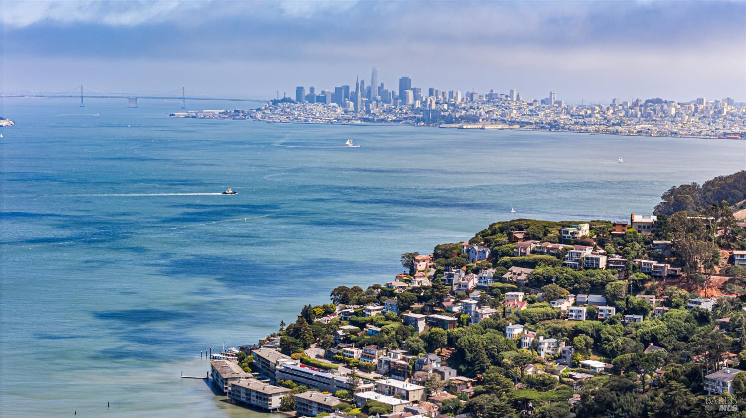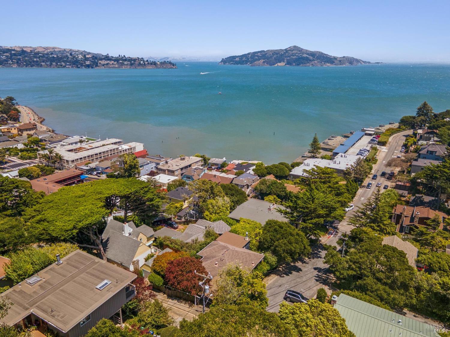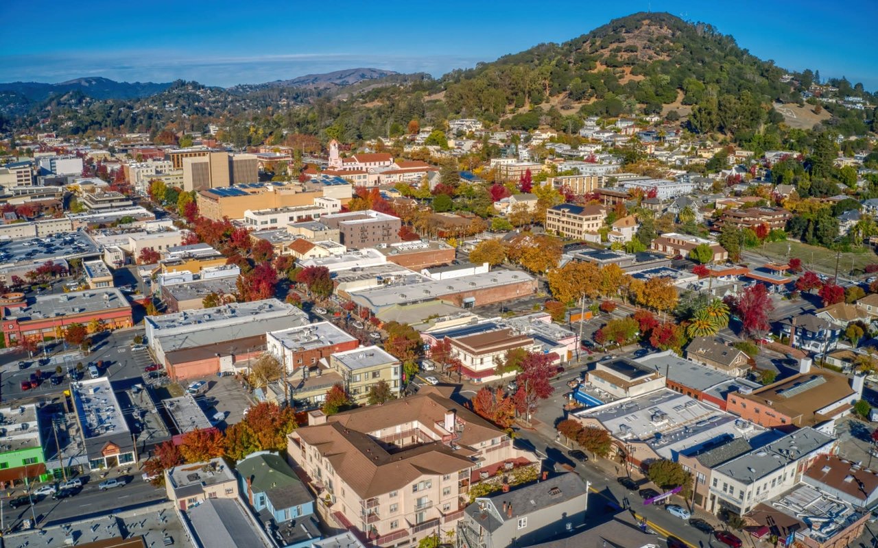
Just across the Golden Gate Bridge from San Francisco sits Sausalito, a waterfront enclave known for its hillside architecture and sweeping views of the San Francisco Bay. Buyers looking at Marin County real estate often focus on this city for its immediate proximity to the urban core paired with a distinct, coastal atmosphere. Understanding the local housing inventory and transit infrastructure is essential for anyone planning a move here in 2026.
The city offers a highly specific lifestyle centered around the water, from historic harbors to expansive hiking trails in the Marin Headlands. Navigating the property market here requires knowing the difference between a traditional single-family home on the hill and a floating property on Richardson Bay. This breakdown covers the essential data on current property values, commute logistics, and local amenities to help you evaluate the area objectively.
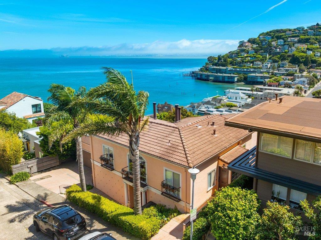
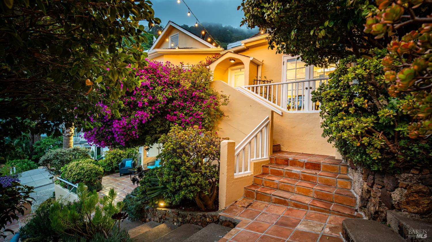
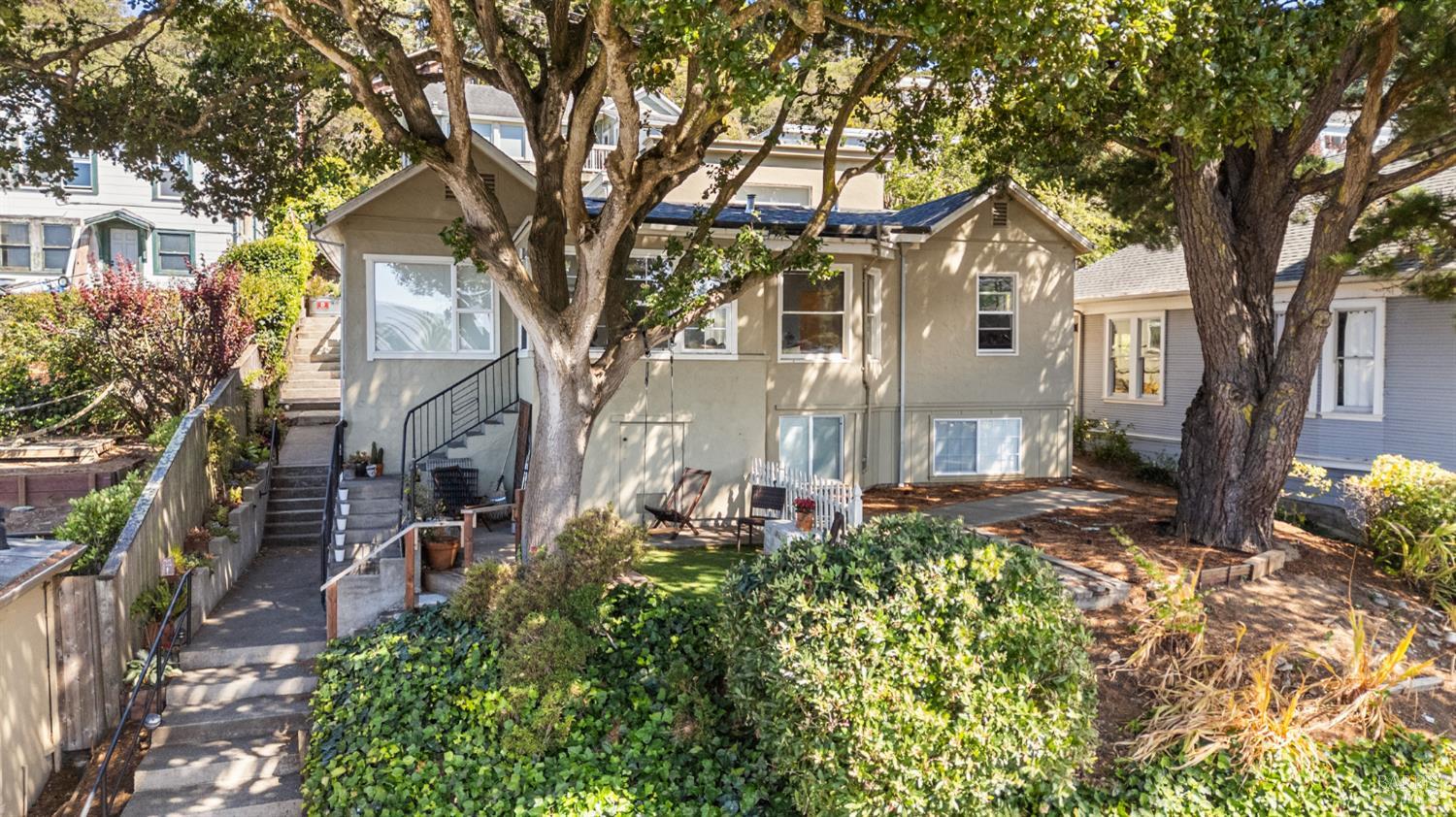
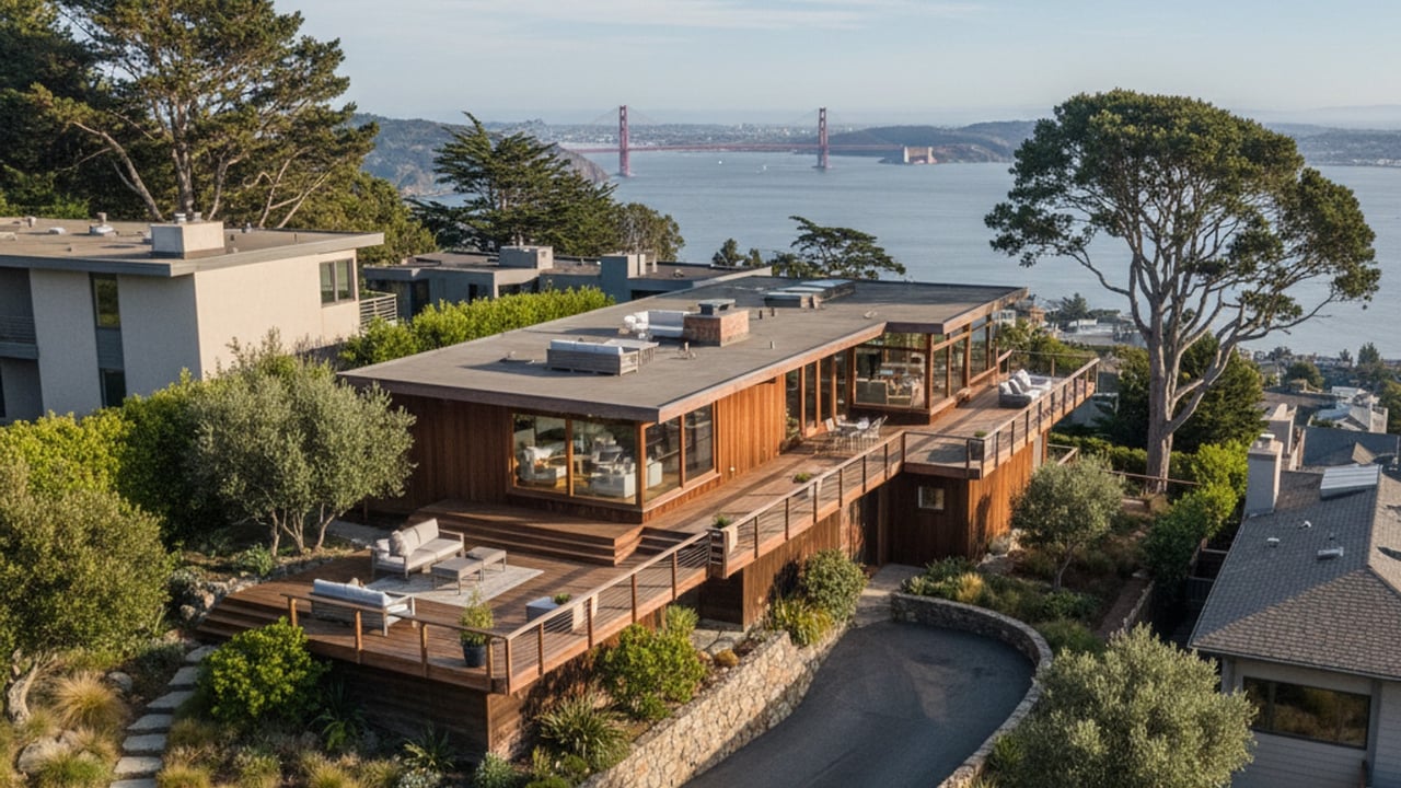
Relocating to this part of Marin County means adjusting to a unique geographic footprint where flat land is exceptionally rare. Buyers must weigh the aesthetic benefits of panoramic water views against the practical realities of steep driveways and tiered lot configurations. A thorough evaluation of these local nuances will ensure you make an informed investment in the current market.
The 2026 housing market in Sausalito presents a distinct split between attached condominiums and sprawling detached estates. Currently, the overall median home price hovers between $1,500,000 and $2,100,000 across all property categories. Buyers specifically seeking single-family detached homes should expect median prices averaging closer to $2,500,000.
Hillside properties that offer unobstructed views of the San Francisco skyline consistently command the highest price premiums in the city. These homes often feature tiered lot designs, expansive outdoor decks, and mid-century or contemporary architectural styles tailored to the steep terrain. The engineering required to build and maintain these hillside foundations is a significant factor in their elevated valuations.
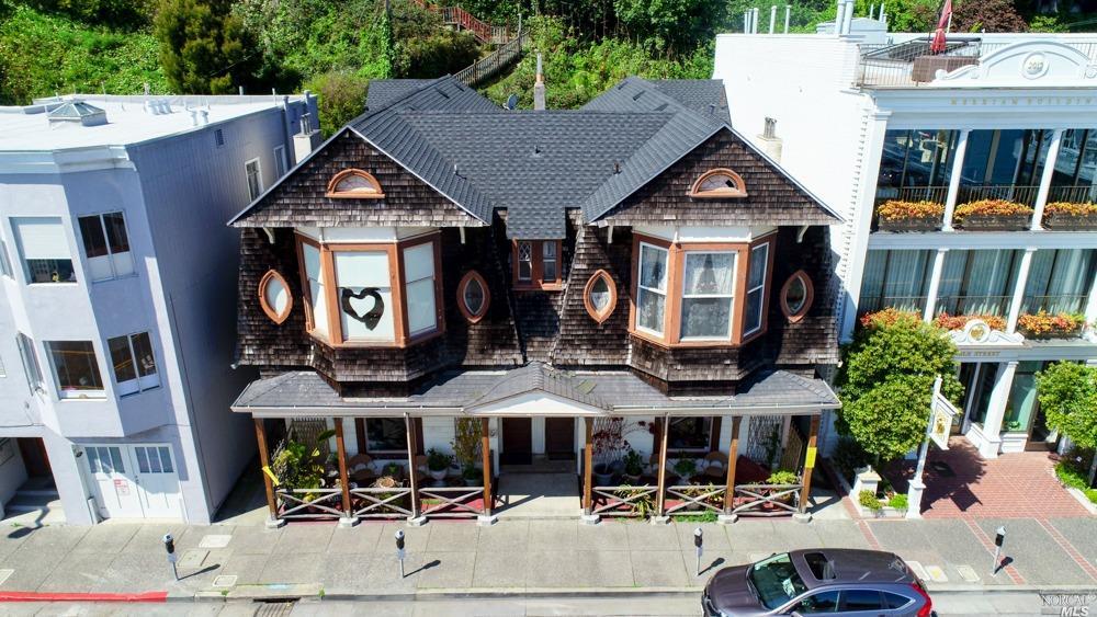
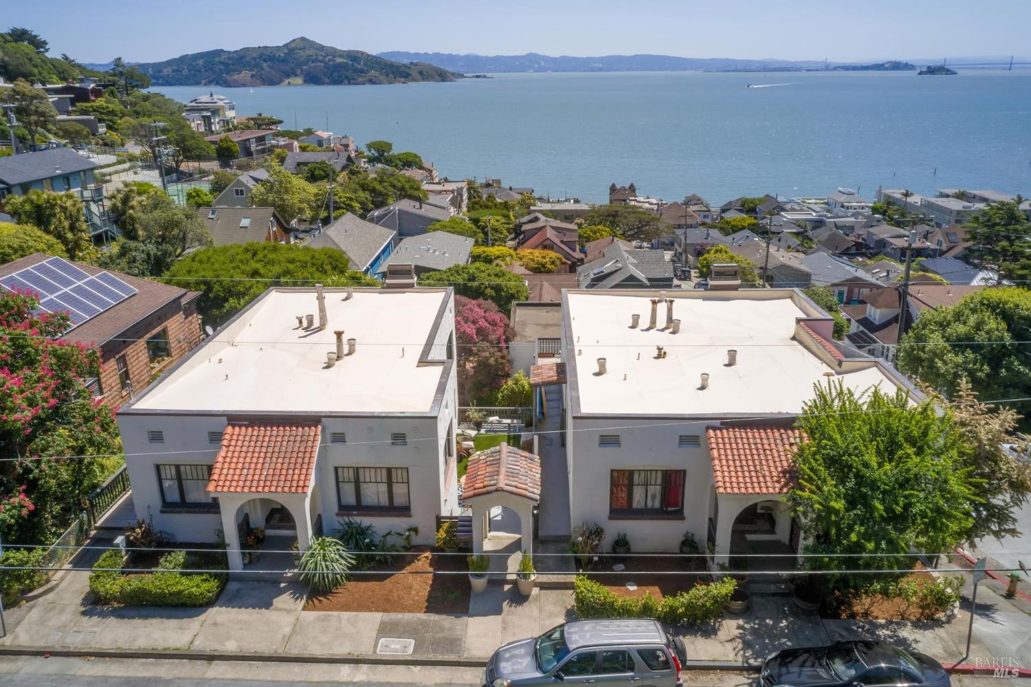
Meanwhile, traditional waterfront homes near downtown Sausalito offer smaller lot sizes but provide immediate access to the commercial center. These properties appeal to buyers who prioritize walkability to local restaurants and the ferry terminal over expansive square footage. Inventory in this lower-elevation sector remains historically tight, driving intense competition when well-maintained parcels hit the market.
Navigating this market requires a clear understanding of land value versus structural square footage. Buyers will find that steep hillside parcels often limit usable yard space, making the interior layout and deck square footage the primary drivers of property value. Securing a home with dedicated off-street parking is a crucial factor that heavily influences resale potential in these dense residential corridors.
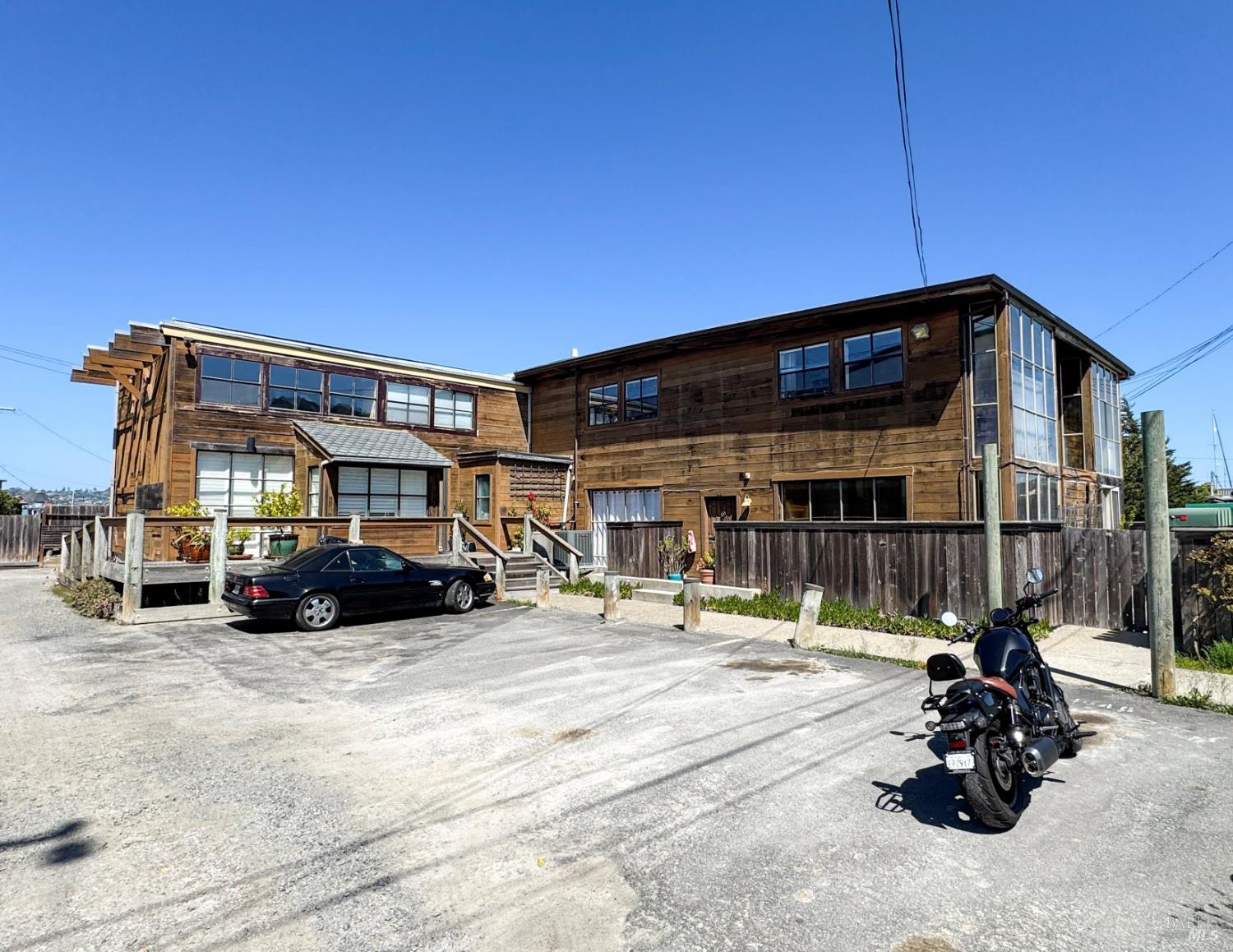
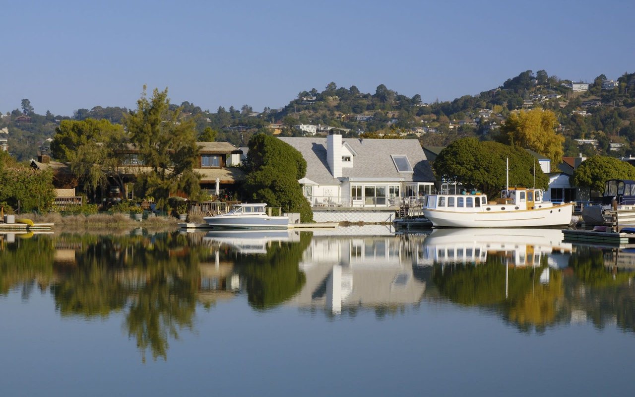
Located at the northern end of town, the historic Waldo Point Harbor floating home community represents a unique segment of the local real estate market. Houseboat prices in 2026 start around $700,000 for smaller, older units, while luxury multi-level models frequently exceed $2,500,000. These properties feature a massive variance in square footage, interior finishes, and architectural styles.
Purchasing a floating home involves different financial logistics than buying a traditional land-based parcel. Buyers must factor in monthly berth rental fees, which are leased separately from the physical structure itself. These dock fees cover water access and harbor maintenance, adding a continuous carrying cost that must be calculated into your monthly housing budget.
The lifestyle on the docks provides an entirely different residential experience compared to the hillside estates. Residents navigate wooden boardwalks to reach their front doors, and the proximity to the water means dealing directly with the tidal shifts of Richardson Bay. Financing these homes also requires specialized lenders who understand the distinct legal classification of floating properties.
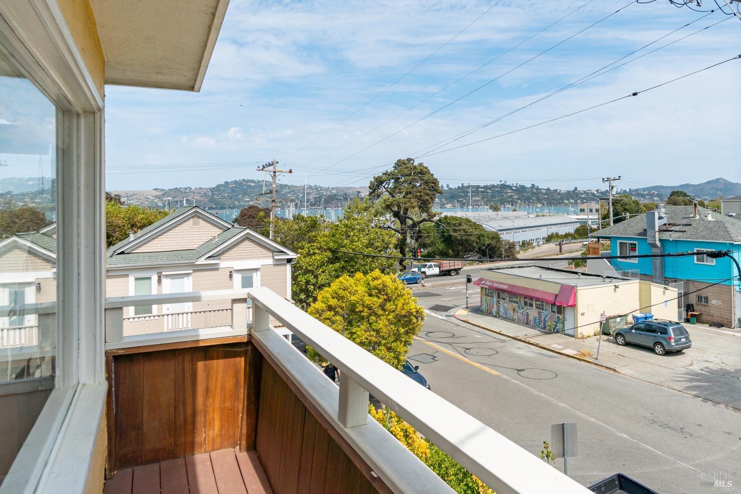
The transit infrastructure connecting Sausalito to the greater San Francisco Bay Area is highly developed, offering multiple daily routes into the city. Depending on your exact location in town, the trip across the water or over the bridge provides varying levels of predictability. Assessing your daily travel requirements is a critical step before finalizing a neighborhood choice.
Commuters generally choose between three primary transit methods to reach the urban core. Each option requires balancing speed, cost, and schedule reliability based on current 2026 traffic patterns.
Golden Gate Ferry: Operating out of the downtown Sausalito Ferry Terminal, this service offers a 25-minute to 35-minute sailing time. When factoring in walking or parking, the total door-to-door commute generally ranges from 45 to 75 minutes.
Highway 101 South: Driving across the Golden Gate Bridge covers roughly 8 to 12 miles depending on your destination in the city. Off-peak drives take under 30 minutes, but peak rush hour traffic easily stretches this to 60 minutes or more, alongside bridge toll costs.
Golden Gate Transit: This regional bus network provides an alternative public transit route across the bridge. It serves multiple stops throughout Marin County before dropping riders at key commercial hubs in San Francisco.
The ferry is consistently the preferred transit method for daily commuters due to its strict schedule predictability. Relying on Highway 101 exposes drivers to frequent bottleneck delays at the bridge toll plaza, making the water route a much less stressful daily routine. Biking across the Golden Gate Bridge is also an option for active residents, though it requires navigating heavy tourist foot traffic during the summer months.
The public education pathway for local residents begins with the Sausalito Marin City School District. This district serves elementary and middle school students living within the immediate geographic boundaries of the city. Recent consolidation efforts have streamlined the district's operations into the Martin Luther King Jr. Academy campus.
This K-8 structure means that all primary and middle school students attend the same central facility before moving on to secondary education. Consolidating the campuses has allowed the district to centralize its administrative resources and academic programs. Buyers researching local property boundaries should verify exact enrollment zones directly with the district office before making an offer.
The physical location of the K-8 campus requires a short drive or bus ride for students living in the steep northern hills of the city. Transportation logistics are an important consideration, as the winding residential roads do not typically feature wide sidewalks for pedestrian access. The district provides updated bus routing information annually to accommodate the dispersed student population.
For secondary education, the area falls under the jurisdiction of the Tamalpais Union High School District, which serves students in grades 9 through 12. Local Sausalito students are geographically assigned to Tamalpais High School, which is located just north in the neighboring city of Mill Valley. This high school campus draws students from several surrounding Marin County communities, creating a large, regional student body.
The city limits contain numerous objective geographical and recreational amenities anchored by the San Francisco Bay Trail. This paved pathway provides miles of public access points for biking and walking directly along the water's edge. It serves as a primary non-motorized transit corridor connecting the northern marinas to the southern downtown commercial district.
Several distinct waterfront parks break up the shoreline, offering specific municipal facilities for residents. Dunphy Park provides open green space and waterfront access, while Gabrielson Park sits adjacent to the ferry terminal. Gabrielson Park functions as a central gathering space and frequently hosts live music and municipal events throughout the summer months.
Beyond the immediate municipal parks, the city sits in immediate proximity to the Golden Gate National Recreation Area. This massive protected zone includes the Marin Headlands, offering extensive hiking trail access and landmarks like the Point Bonita Lighthouse. The terrain here transitions quickly from paved city streets to rugged coastal trails overlooking the Pacific Ocean.
Additional local centers include the Bay Area Discovery Museum at Fort Baker and The Marine Mammal Center, both providing specialized regional programming. Fort Baker also offers expansive views of the bridge and features historic military architecture preserved by the National Park Service. These local institutions provide substantial recreational value without requiring residents to cross the bridge into San Francisco.
In early 2026, the overall median home price in the city ranges between $1,500,000 and $2,100,000. Single-family detached homes average roughly $2,500,000, while smaller condominiums or introductory floating homes offer lower entry points. Properties with unobstructed views of the San Francisco Bay consistently sell at the top end of the market.
Yes, you can drive directly into San Francisco via Highway 101 South across the Golden Gate Bridge. The trip is approximately 8 to 12 miles and typically takes under 30 minutes during off-peak hours. During heavy morning and evening rush hours, this drive frequently stretches beyond 60 minutes.
The local housing inventory is heavily defined by steep hillside estates featuring mid-century and contemporary architecture. Traditional waterfront single-family homes and attached condominiums are also prevalent near the downtown sector. Additionally, the city is famous for its large concentration of floating homes located in Waldo Point Harbor.
7,171 people live in Sausalito, where the median age is 55.8 and the average individual income is $141,034. Data provided by the U.S. Census Bureau.
Total Population
Median Age
Population Density Population Density This is the number of people per square mile in a neighborhood.
Average individual Income
There's plenty to do around Sausalito, including shopping, dining, nightlife, parks, and more. Data provided by Walk Score and Yelp.
Sausalito has 4,111 households, with an average household size of 1.74. Data provided by the U.S. Census Bureau. Here’s what the people living in Sausalito do for work — and how long it takes them to get there. Data provided by the U.S. Census Bureau. 7,171 people call Sausalito home. The population density is 4,065 and the largest age group is Data provided by the U.S. Census Bureau.
Total Population
Population Density Population Density This is the number of people per square mile in a neighborhood.
Median Age
Men vs Women
Population by Age Group
0-9 Years
10-17 Years
18-24 Years
25-64 Years
65-74 Years
75+ Years
Education Level
Total Households
Average Household Size
Average individual Income
Households with Children
With Children:
Without Children:
Marital Status
Blue vs White Collar Workers
Blue Collar:
White Collar: