Updated on: October 29, 2026
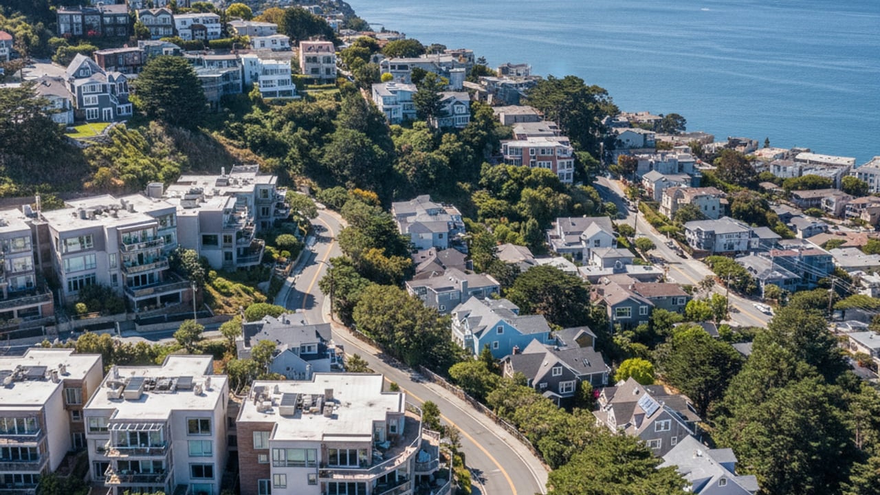
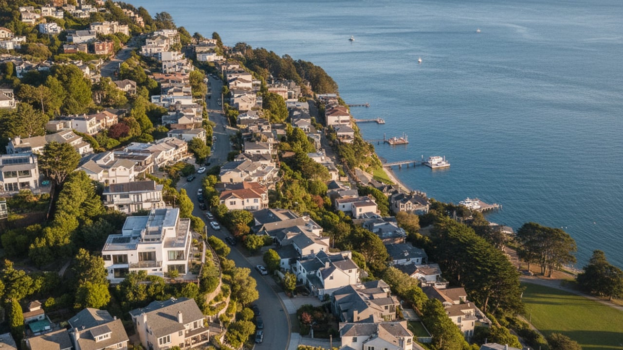
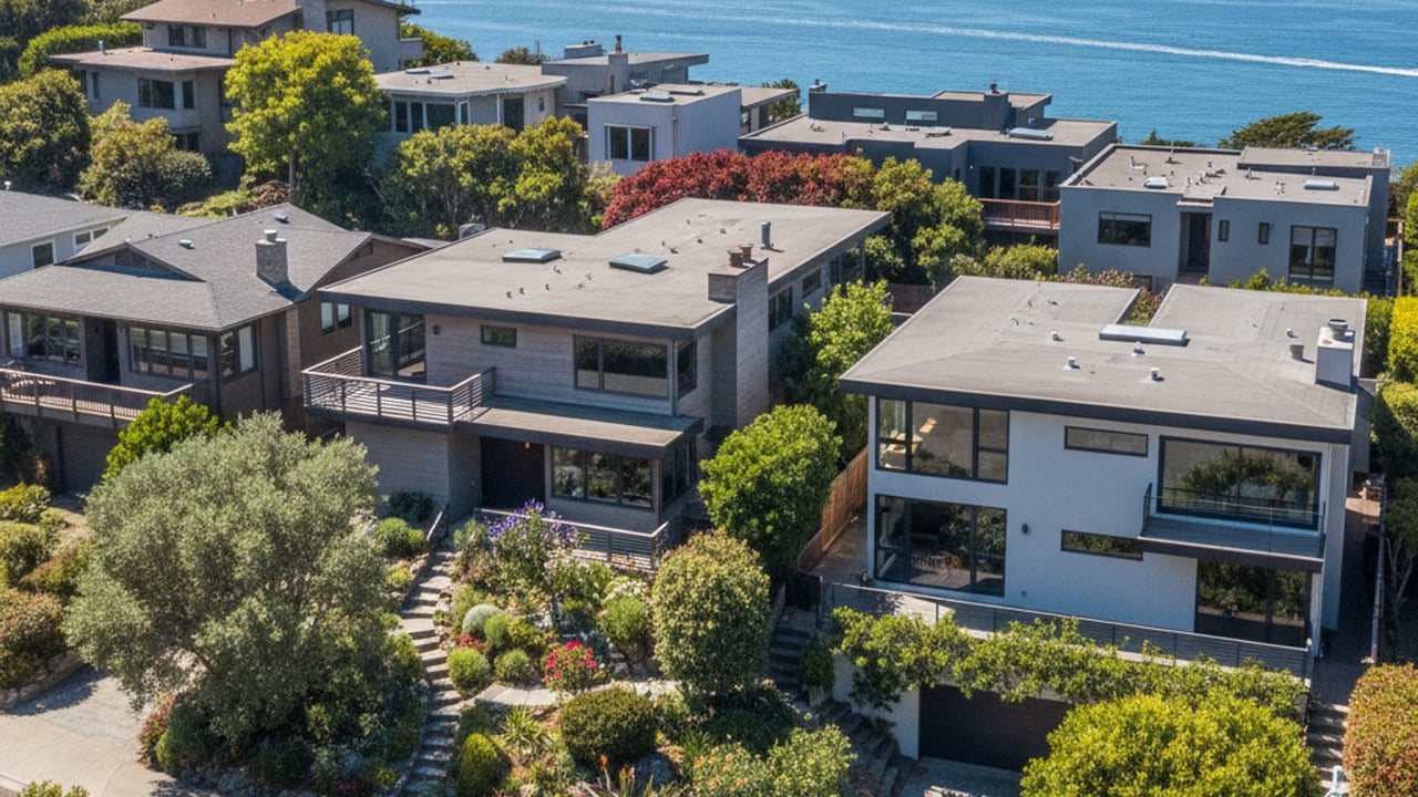
Living in Sausalito, CA means life in a small waterfront town in southern Marin County, at the north end of the Golden Gate Bridge, where homes climb steep hillsides above the bay and floating homes line the north-end docks. Its hillside streets and bayfront setting make it one of the most in-demand residential markets in Northern California.
Key takeaway
Sausalito is a small town on the north side of the Golden Gate Bridge, built on steep hills above the bay. Daily life trades space, parking and a high cost of entry for water views, a walkable downtown and a ferry ride to San Francisco. Homes range from hillside houses and condos to floating homes on the north-end docks, and housing costs sit near the top of Marin.
Who this guide is for
Renters and buyers weighing a move to Sausalito who want to know what daily life, commuting and the home choices are like.
Side-by-side comparisons: vs Stinson Beach, vs Corte Madera, vs Tiburon, vs San Rafael, vs Belvedere, vs Mill Valley, vs Larkspur, vs San Francisco. Related guides: Is Sausalito, CA safe, History of Sausalito, Cost of living in Sausalito, Moving to Sausalito, Weather and climate in Sausalito, Retirement communities in Sausalito, Is Sausalito, CA good for families, Job market Sausalito, Getting around Sausalito, Things to do in Sausalito, Schools in Sausalito.
Living in Sausalito at a glance
- 7,021 residents (2023 Census estimate) on 1.76 square miles.
- Golden Gate Ferry: about 30 minutes, $8.50 adult Clipper fare.
- Bridge toll: $10.25 with FasTrak, southbound only, no cash lane.
- Public schools: Sausalito Marin City district for TK-8, then Tamalpais Union High.
What it's like to live in Sausalito
The town rises straight from the bayfront, with residential streets stacked one above another over Bridgeway. From many homes the view takes in the bay, Angel Island, Alcatraz and the San Francisco skyline, with Mt. Tamalpais behind town. Sausalito had 7,021 residents in the U.S. Census Bureau's July 1, 2023 estimate, living on just 1.76 square miles of land, so the town feels compact.
Sausalito began as a stop for sailing ships and a fishing settlement, served as a ferry transit point before the bridge opened, and later grew into a maritime and shipbuilding center. In the 1960s and 1970s its waterfront drew artists, writers and musicians. Smithsonian Magazine documents that children's author and illustrator Shel Silverstein lived on a houseboat called the Evil Eye in the floating-home community near Waldo Point Harbor. It also records that rock guitarist Dino Valenti lived on the waterfront, and that Whole Earth Catalog creator Stewart Brand has lived on the tugboat Mirene there since 1982.
Day to day, visitors gather downtown at the south end, around the ferry landing and Bridgeway, while most residential streets above and north of downtown stay quiet. A broader look at the community is available in the ultimate guide for Sausalito.
Sausalito's main areas: Old Town to Wolfback Ridge
Sausalito's rugged terrain shaped where and how each part of town was built. The City of Sausalito's Historic Context Statement names seven historic neighborhoods, and these five are the ones newcomers hear about most often.
Old Town, New Town and Spring Street Valley sit in the town's gently sloping valleys. They began as compact rows of cottages for shipwrights, railroad workers and other laborers, within walking distance of waterfront workplaces, schools and shops. Today they are mostly older single-family cottages mixed with later infill. Their gentler grades make walking to downtown and the waterfront easier than from the hillsides.
The Hill is the steep hillside area, mainly historic single-family estate homes on irregular, pie-shaped terraced lots. Its streets climb in switchbacks, held up by retaining walls, and the elevation brings bay views along with steep walks to town.
Wolfback Ridge was laid out later, as a mid-20th-century subdivision. Its streets follow the natural line of the ridge rather than the original grid, so roads wind instead of forming blocks.
Homes in Sausalito: types, prices and renting
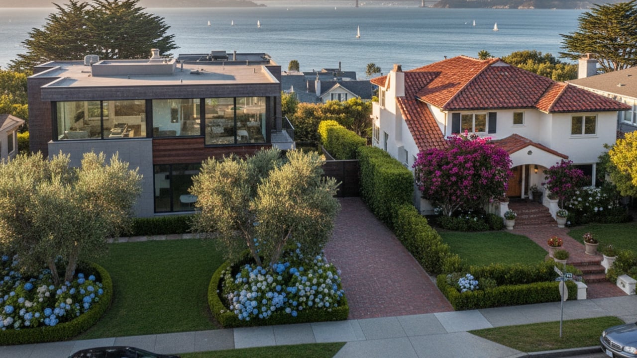
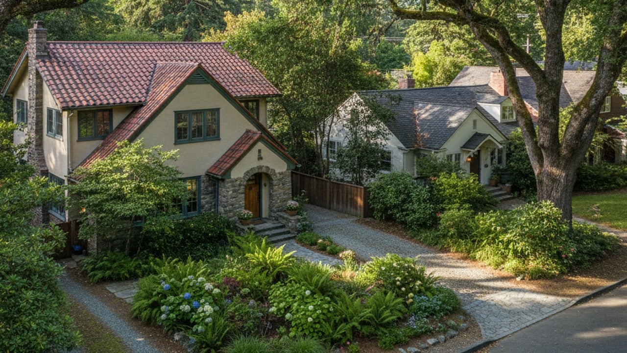
Sausalito's housing falls into three groups:
- multi-level hillside single-family homes, including older and restored houses;
- condos and townhomes near downtown and along the flats;
- floating homes.
Price moves with elevation, water views and walking distance to downtown, so two homes of similar size a few streets apart can sell for very different amounts. Price trends and inventory shift month to month, so check recent sold data before setting a budget. If you want a current price snapshot for a specific street or home type, I can pull recent sales for you.
Renting first is a common way to try the town before buying. Inventory is tight for both rentals and homes for sale, so prospective residents should prepare for competitive application processes.
Housing is the main driver of the cost of living in Sausalito and keeps overall costs high even by Marin standards.
Houseboat and floating home living
Sausalito's floating homes line docks along Richardson Bay near Gate 5 Road. The Floating Homes Association represents the residents of more than 400 floating homes in five floating-home marinas on the bay.
Buying one differs from buying a house on land. The marinas are privately owned, so a buyer owns the floating home itself and pays the marina a monthly slip fee for the berth instead of owning the slip underneath.
Financing and insurance also work differently than for a land home, so speak with a lender and an insurer about the specific floating home before writing an offer. Slip fees and any association dues vary by dock, so budget them alongside the purchase cost.
Daily life on the docks has its own rhythm. Homes line narrow boardwalks, cars stay in parking areas ashore, and groceries get carried down the dock. Neighbors pass each other's doors every day, which gives the marinas a close community feel. Weather and tides are also part of the routine in a way they are not on the hillside.
Getting to San Francisco: ferry, car, bus, bike or on foot
Golden Gate Ferry, run by the Golden Gate Bridge, Highway and Transportation District, sails from downtown Sausalito to the foot of Market Street at the Embarcadero, Gates B and C behind the San Francisco Ferry Building. The crossing averages about 30 minutes, and bikes ride first come, first served. As of July 1, 2026, an adult one-way fare with Clipper or a contactless bank card costs $8.50. Blue & Gold Fleet has also offered service between Sausalito and Pier 41.
For commuters, the downtown terminal is within walking distance of the valley neighborhoods, and the ferry fare costs less than the bridge toll.
Driving means heading south on Highway 101 over the Golden Gate Bridge. The drive can take as little as 15 minutes without traffic, but peak-hour times are hard to predict. The bridge charges only in the southbound direction, into San Francisco, and has no cash lanes, so drivers without FasTrak are billed by license plate. From July 1, 2026, a two-axle car pays:
- $10.25 with FasTrak;
- $10.50 through a License Plate Account or One-Time Payment;
- $11.25 by mailed Toll Invoice.
Golden Gate Transit bus routes serve Highway 101 with dedicated stops throughout Marin County, giving commuters a road option without driving.
You can walk or bike to San Francisco across the bridge. Downtown Sausalito to the San Francisco end of the bridge is roughly 4 miles one way. Pedestrians use the east sidewalk, open 5:00 AM to 6:30 PM in winter and 5:00 AM to 9:00 PM in summer.
Cyclists can cross 24 hours a day. On weekdays they share the east sidewalk until 3:30 PM, then switch to the bike-only west sidewalk until closing. On weekends and holidays they may use either side until closing. A common plan is to ride over and take the ferry back.
Everyday life: dining, shopping and errands
Bridgeway, along the waterfront, holds most of the restaurants, cafes and galleries. Caledonia Street is where locals eat and shop day to day, away from the tourist crowds.
Two local grocery stores sit on Caledonia:
- Driver's Market & Deli at 200 Caledonia Street, which stocks organic and local groceries and is open daily from 8:00 AM to 8:30 PM;
- Sausalito Market at 46 Caledonia Street.
For larger errands, residents drive along Highway 101 to neighboring Marin towns.
Local amenities, parks, and recreation
The Bridgeway promenade is the town's main waterfront path, with direct access to local marinas for boating, sailing and paddleboarding. Dunphy Park and Gabrielson Park provide waterfront lawns and space for community events.
Beyond the shoreline, residents have quick access to the Marin Headlands trails in the Golden Gate National Recreation Area at the south end of town. The area offers beaches, walks such as Kirby Cove, and extensive hiking and cycling.
Schools serving Sausalito
The Sausalito Marin City School District serves students from transitional kindergarten through grade 8 on two campuses:
- the Nevada Campus in Sausalito, for TK through grade 5;
- the Phillips Campus (Martin Luther King Jr. Academy) in neighboring Marin City, for grades 6 through 8.
High school students then move to the Tamalpais Union High School District. School-by-school programs, enrollment and bond projects change from year to year, so check with each district before deciding.
Weighing the pros and cons of living in Sausalito
Pros:
- Bay and city views, with waterfront access along Bridgeway and the marinas.
- A walkable downtown.
- The ferry as an alternative to the bridge drive.
- Open space next door in the Marin Headlands.
Cons:
- Steep hills and limited street parking.
- Visitor traffic along Bridgeway on summer weekends.
- Tight inventory, so few homes or rentals come up at once.
- A high cost of entry.
- Fog and microclimates vary by hillside and by side of town, so weather can change within a short distance.
Frequently asked questions
Is it expensive to live in Sausalito, CA?
Yes. Housing is the largest cost, with home prices and rents near the top of Marin, and commuters add the bridge toll or ferry fare as a recurring cost.
Can you live on a boat in Sausalito?
Yes, in a marina slip, which is different from owning a permitted floating home. Several established Sausalito marinas accept liveaboard vessels, with the share of liveaboards each marina may house set by the California Coastal Commission.
Anchoring in Richardson Bay without a permit is limited to 72 hours. Long-term anchor-outs were phased out under a 2021 agreement between the Richardson Bay Regional Agency (RBRA) and the San Francisco Bay Conservation and Development Commission, with the strict 72-hour limit in place as of the October 26, 2026 deadline. The RBRA is the main enforcing body, and the Marin County Sheriff's Department has also been involved in enforcement.
Are parts of Sausalito in a flood zone?
Yes. Low-lying bayfront and Marinship areas, including spots near Bridgeway, Gate 5 and 6 Roads and Liberty Ship Way, fall within FEMA Special Flood Hazard Areas (Zone A or Zone V) on flood maps last updated in 2016. The City of Sausalito notes that flood insurance is federally required for most mortgage holders in these high-risk areas, so price it in before making an offer. Check a specific address on the FEMA flood map.
Is Sausalito part of San Francisco?
No. Sausalito is a separate city in Marin County, across the Golden Gate Bridge from San Francisco, with its own city government.
Sources
- U.S. Census Bureau QuickFacts: Sausalito city, California (population estimate)
- U.S. Census Bureau QuickFacts: Sausalito city, California (land area)
- Smithsonian Magazine: Livin' on the Dock of the Bay
- City of Sausalito: Citywide Historic Context Statement
- Sausalito Chamber of Commerce: Non-profit highlight, Floating Homes Association
- Sausalito Chamber of Commerce: Bikes, busses, ferries
- Golden Gate Ferry: Ferry fares and payment
- 511 SF Bay: Bridge tolling information
- SF Tourism Tips: San Francisco to Sausalito
- Golden Gate Bridge: Walking and biking
- Golden Gate Guide: Bike across the bridge
- Islands: Sausalito's second downtown
- Driver's Market & Deli
- San Francisco Chronicle: Richardson Bay anchor-out boats
- California County News: Anchor-out battle reaches final showdown in Richardson Bay
- City of Sausalito: Sea level rise and FEMA flood insurance
Read More Articles
Work With Tracey
Follow Me on Instagram
Contact Details
Tracey Broadman | CA DRE# 01323049
Phone
Address
352 MILLER AVE MILL VALLEY CA 94941