Updated on: October 29, 2026
The best neighborhoods in Mill Valley, CA are Downtown and Old Mill, Sycamore Park, Cascade Canyon, Middle Ridge and Blithedale Canyon, Country Club and Boyle Park, Tam Valley and Almonte, Homestead Valley, Strawberry, Alto/Sutton Manor/Horse Hill, and Scott Valley. The right one for you depends on three trade-offs:
- level flats versus canyon versus hillside
- sun versus redwood shade
- nearness to downtown versus nearness to Highway 101
Across Mill Valley, those trade-offs shift from one street to the next, along with lot usability, upkeep and commute access.
Key takeaway
Choose the setting before the house. Flat streets near downtown carry the highest prices. Tam Valley and Almonte offer the lowest entry price. Canyon and ridge homes give up sun or walkability in exchange for trail access. Before choosing, check the fire and flood hazard maps and whether the address is inside city limits.
Who this guide is for
Buyers comparing Mill Valley neighborhoods before touring homes, whether relocating from San Francisco or moving within Marin.
More neighborhood guides: Downtown, Shelter Ridge, Tamalpais Valley, Blithedale Canyon, Alto.
Mill Valley neighborhoods at a glance
- Mill Valley single-family median: $4,100,000 in August 2026.
- Strawberry, Tam Valley, Homestead, Almonte and Alto: unincorporated Marin County.
- 2025 CAL FIRE maps expanded very high fire zones on hillsides.
- Owners in those zones must keep defensible space under Ordinance 1364.
- Closest to Highway 101: Strawberry and the Tam Junction/Almonte corridor.
Mill Valley home prices in 2026
Mill Valley recorded 11 single-family home sales in August 2026 at a median sale price of $4,100,000, up 52.1% from $2,695,000 in August 2025. The figures come from Marin County Assessor-Recorder-County Clerk data reported by the Mill Valley Briefing. That month's sales leaned toward larger, remodeled, move-in-ready homes. With so few closings, one month's median moves with the mix of homes sold.
Prices also vary sharply from one pocket to the next. Judge any home against recent sales in the same pocket, matched for lot type, condition and remodel level. Inventory levels and offer strategy in the Mill Valley housing market change month to month, so check current conditions before setting a price.
Mill Valley neighborhoods map
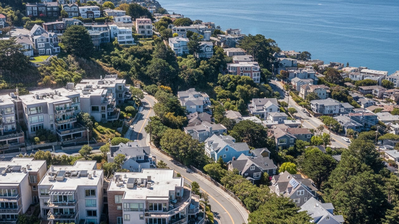
Most of Mill Valley, including the original downtown and Old Mill village, lies west of Highway 101 in valleys and hillsides that descend from Mt. Tamalpais. Boundaries on the map are approximate.
- Toward Mt. Tam and the canyons: From south to north, the town's valleys run Tamalpais Valley, Homestead Valley, Cascade Canyon and Blithedale Canyon. Middle Ridge separates Cascade and Blithedale canyons. Homestead Valley meets the Golden Gate National Recreation Area on its west side.
- Around downtown: Downtown and Old Mill form the center. Sycamore Park lies just south of the adjoining Tamalpais Park area, which is close to downtown. Boyle Park and the city golf course anchor the Country Club and Boyle Park area. Scott Valley's edges are best confirmed on the city limits map.
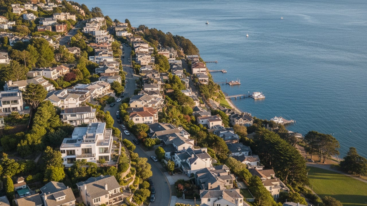
- Along Richardson Bay and Highway 101: East of the highway, Mill Valley shares the Strawberry Peninsula on Richardson Bay with Tiburon. Almonte rises from level land on the southwest side of Miller Avenue to a low ridge separating Mill Valley from Tamalpais Valley.
Comparing the top neighborhoods in Mill Valley
The names below are informal local and MLS labels with no official boundaries. A Mill Valley mailing address also does not place a home inside city limits. According to the City of Mill Valley, addresses in Strawberry, Tam Valley, Homestead Valley, Almonte and Alto sit in unincorporated Marin County. For an owner, that means permits and planning go through the Marin County Community Development Agency's Planning Division instead of the city. Some of these areas also fall under the Tamalpais Area Community Plan. Check any address against the city limits map before relying on city rules.
Downtown Mill Valley and Old Mill
Homes within walking distance of the plaza are older and closely spaced, many dating to Mill Valley's years as a summer retreat for San Franciscans. On the hillside streets near the base of the Dipsea Steps, craftsman homes sit on wooden beams above the slope.
Old Mill Park, site of Marin County's first sawmill, is about two blocks from the plaza. It serves as the trailhead for the Dipsea Stairs, roughly 680 to 700 steps climbing toward the Dipsea Trail, Muir Woods and Stinson Beach. Redwoods shade much of the Old Mill area, so expect cooler, darker lots than on the open flats.
Lot size and off-street parking vary house by house, so confirm both on each listing. Downtown's shops, restaurants and events are a short walk from these streets.
Sycamore Park
Sycamore Park has flat topography, which makes it one of the most accessible areas in town. Traditional single-family homes sit on level lots with mature landscaping, and a walkable grid connects directly to the downtown commercial district. Buyers pay a premium here to avoid the narrow, winding access roads higher up the hills.
Despite the similar name, the adjoining Tamalpais Park area is separate from Tamalpais Valley, which sits to its southwest.
Cascade Canyon
Cascade Canyon is a quiet, redwood-shaded residential area along Cascade Creek. At the end of Cascade Drive, a short trail through a redwood grove in the city's Cascade Park leads to Cascade Falls, a 15-foot waterfall that runs all year. A preserve with a similar name, Cascade Canyon Open Space Preserve, is in Fairfax, so check which one a listing refers to.
The setting brings practical trade-offs: narrow, winding roads, limited parking, and deep shade that keeps lots damp through winter.
Middle Ridge and Blithedale Canyon
Middle Ridge is the high ground between Cascade Canyon and Blithedale Canyon. Homes on the ridge get more sun, while the canyon floor below sits in filtered redwood shade.
Both reach Blithedale Summit Open Space Preserve, which runs along Mt. Tamalpais's ridge between Mill Valley, Corte Madera and Larkspur. Trailheads sit at the end of Summit Avenue and off West Blithedale Avenue. From the preserve, fire roads such as Blithedale Ridge Fire Road and Old Railroad Grade connect to the wider Mt. Tam trail network.
Expect steep driveways and narrow streets on both the ridge and in the canyon.
Country Club and Boyle Park area
This area centers on two city facilities:
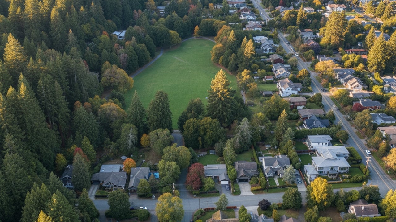
- Boyle Park: At East Blithedale Boulevard and East Drive, the park has a large open lawn, tennis courts that require passes, a playground, a baseball diamond, picnic and barbecue areas, restrooms and creek access. Leashed dogs are allowed.
- The Mill Valley Golf Course: Next to the park, it is a city-owned 9-hole, par-33 course on 42 acres of redwoods and hills at the base of Mt. Tamalpais. The city bought it in 1939.
Terrain and lot size change from street to street, so compare the slope and usable yard of each listing.
Tamalpais Valley and Almonte
Tamalpais Valley, known locally as Tam Valley, runs from Highway 101 along Shoreline Highway (Highway 1) toward the ocean. Almonte lies between Tam Valley and Tam Junction, the interchange of Highways 101 and 1.
The housing stock is varied, with modest cottage-style homes alongside larger modern builds set into the hillsides. The entry price is lower than in the downtown flats, which lets buyers stretch a budget while keeping a Mill Valley address. Tam Valley stretches toward the coast rather than toward downtown, so plan on a car for most errands.
The Highway 1 exit off 101 leads to Muir Beach, Stinson Beach and Bolinas. Tennessee Valley Road, off Highway 1 heading west, reaches the Tennessee Valley trailhead in the Golden Gate National Recreation Area.
Homestead Valley
Homestead Valley has wooded lots, with steep streets winding through groves of redwoods. Homes range from original rustic cabins to larger custom homes on bigger parcels. Lot usability and sun exposure drive individual values: homes on the sunnier, south-facing ridges draw higher offers than those deep in the shaded ravines.
The Homestead Valley Land Trust, formed in 1974, manages more than 80 acres of county open space in the surrounding hills, plus three local parks: Volunteer Park, Stolte Grove and Three Groves. A community center leased from the county is funded through County Service Area 14 tax revenues.
Strawberry
Strawberry sits along Richardson Bay, with many homes looking out over the water and a generally sunnier microclimate than the central canyons. Housing mixes traditional single-family homes with attached communities that charge monthly HOA dues. For an attached home, check the association's reserves before writing an offer.
Strawberry Village, on Redwood Highway Frontage Road, has a Safeway, banking, dental care, other shops and restaurants, and a farmers market on Tuesdays.
Alto, Sutton Manor and Horse Hill
Alto, in unincorporated Marin County, and Sutton Manor, inside the city of Mill Valley, both sit at the base of Horse Hill, which gives the combined area its local name. The Marin County Open Space District owns the 55-acre Horse Hill Open Space Preserve above them. There, the Alto Bowl Horseowners' Association manages grazing horses and equestrian facilities.
The area is a recognized Firewise Community with an active Neighborhood Response Group, a fire-preparedness network to ask about when you tour. The city line runs between Alto and Sutton Manor, so the permit agency can differ between nearby homes.
Scott Valley
Scott Valley is home to the Scott Valley Swimming & Tennis Club, a private club at 50 Underhill Road offering swim, tennis and fitness programs. The city's network of public steps, lanes and paths reaches Scott Valley, giving walking routes off the main roads. Lot sizes and housing types vary, so compare each listing's lot and street grade directly.
Mill Valley neighborhoods compared side by side
Sorted by priority:
- Walking to downtown: Downtown and Old Mill, and Sycamore Park.
- Trails close to home: Cascade Canyon, Middle Ridge and Blithedale Canyon, and Homestead Valley.
By neighborhood:
- Downtown and Old Mill: older, closely spaced homes; hillside streets near the plaza; redwood shade near Old Mill; walk to the plaza.
- Sycamore Park: single-family homes on level lots; flat; open light; walkable grid to downtown.
- Cascade Canyon: creekside canyon homes; narrow winding roads; deep redwood shade; trail to Cascade Falls.
- Middle Ridge and Blithedale Canyon: ridge and canyon homes; steep driveways; sun on the ridge, shade below; fire road access to Mt. Tam.
- Country Club and Boyle Park: terrain varies by street; next to Boyle Park and the city golf course.
- Tamalpais Valley and Almonte: cottages to modern hillside builds; level land rising to hills; at Tam Junction.
- Homestead Valley: cabins to custom homes; steep wooded streets; sunny ridges, shaded ravines; land trust open space.
- Strawberry: single-family and attached HOA homes; bayfront; sunnier; beside Highway 101.
- Alto, Sutton Manor and Horse Hill: homes at the base of Horse Hill; open space preserve above; split city and county.
- Scott Valley: varied lots; on the public path network; swim and tennis club.
How to choose the right Mill Valley neighborhood
Weigh each area against the property itself.
- Sun versus shade: Light depends on slope orientation as much as neighborhood, so visit in the morning, at midday and in late afternoon before deciding.
- Fire hazard: According to Southern Marin Fire District, CAL FIRE's 2025 Fire Hazard Severity Zone update expanded Very High Fire Hazard Severity Zones in Mill Valley, with hillside and canyon areas most affected.
- Check any address on CAL FIRE's address lookup map.
- In those zones, owners must maintain defensible space and clear combustible vegetation near structures and roadways under City Ordinance No. 1364 (December 8, 2025). The ordinance adopts the 2025 California Fire Code and Wildland-Urban Interface Code.
- The Southern Marin Fire Protection District enforces these rules and also offers home inspections.
- Get homeowners insurance quotes early, before you remove contingencies.
- Flood: FEMA flood zones mapped in Mill Valley include AO, AE, X and Floodway designations tied to the 1% annual chance flood. Marin County's Flood Control Zone 3 (Richardson Bay) covers the city plus Alto, Sutton Manor, Almonte, Tamalpais Valley, Homestead Valley and parts of Strawberry Point. These areas have historically been exposed to creek and tidal flooding. Check the parcel's FEMA zone before you offer.
- Terrain and upkeep: Steep driveways, slopes and drainage add maintenance and can limit parking. For a hillside home, a geotechnical review during inspections shows how the slope and foundation are holding up. For older homes, add roof and sewer line inspections.
- Walkability: The city's Steps, Lanes and Paths network has historically numbered more than 175 heritage steps, lanes and paths. Over seven miles of them connect Miller/Molino, Cascade Canyon, Blithedale Canyon, Warner Canyon/Kite Hill and Scott Valley, and 50 paths lead directly to downtown and City Hall.
- Budget: Work out how much house you can afford in Mill Valley, including taxes, insurance and any HOA dues, before you settle on a pocket.
Commute access by neighborhood
Cascade Canyon, Blithedale Canyon and Homestead Valley sit deeper in the hills, farther from the Highway 101 on-ramps.
- Tam Junction and Almonte: Golden Gate Transit Route 114, a weekday peak-hour commute bus, stops at Tam Junction (Shoreline Highway and Almonte Boulevard) and the Manzanita Park & Ride. The Sausalito Ferry Landing, reached by Golden Gate Transit Route 130 and Marin Transit Routes 17 and 61, is the most direct ferry.
- Strawberry: The Highway 101 and Seminary Drive bus pad serves Routes 130, 132 and 150, and Route 132 runs to the Larkspur Ferry Terminal. The Tiburon Ferry Landing, reached via Tiburon Boulevard and Marin Transit Route 219, is the other option from the east side of town.
Schedules and travel times change by hour and season, so check them when planning how you will get around Mill Valley day to day.
School districts by neighborhood
The Mill Valley School District serves students from kindergarten through eighth grade. Students in grades nine through twelve attend Tamalpais High School at 700 Miller Avenue, part of the Tamalpais Union High School District.
Attendance boundaries decide which elementary campus a home feeds into, and they do not follow ZIP codes or MLS neighborhood tags. A home on one side of a street can be zoned differently from the house across from it. Verify the exact address with the district office before making an offer. Ratings and programs at Mill Valley schools differ by campus, so compare them once you know the assigned school.
Frequently asked questions
What are the sunniest neighborhoods in Mill Valley?
Strawberry, the south-facing ridges of Homestead Valley and Middle Ridge get the most direct sun of the areas profiled here. Mill Valley weather, including fog and temperature, also differs between the bayside and the canyons.
Is Mill Valley, CA a good place to live?
For buyers who want trails close to home, it stands out: Blithedale Summit, the Homestead Valley Land Trust lands and the Dipsea Stairs at Old Mill Park all sit near residential streets. The trade-offs are cost, at that August 2026 median, and fire and flood exposure that each address should be checked for.
Which Mill Valley neighborhoods have the most level streets?
Sycamore Park has the flattest terrain of the areas profiled here, and Almonte begins on level land before rising toward the ridge. The canyon and ridge areas have steep, winding streets, so for single-level living, filter listings by layout as well as location.
Can I buy a condo or townhome in Mill Valley?
Strawberry is the area in this guide where attached homes in HOA communities sit alongside single-family homes; most other areas are mainly single-family.
Sources
- Mill Valley median home price tops $4 million for the first time this year
- Living in Marin: Mill Valley
- City of Mill Valley: Property Permit History Information
- 7x7: The steps and lanes of Mill Valley
- Nextdoor: Tamalpais Park, Mill Valley
- Marin Mommies: Mill Valley's Cascade Falls
- Marin County Visitor: Blithedale Summit Preserve
- City of Mill Valley: Parks
- Wikipedia: Mill Valley, California
- Homestead Valley: Community Partners
- Visit Marin: Strawberry Village
- Mill Valley Historical Society: Horse Hill
- U.S. Masters Swimming: Scott Valley Sea Serpents
- Southern Marin Fire District: Wildland-Urban Interface
- Mill Valley Municipal Code
- Marin County: Flood Control Zones
- Southern Marin Fire District: Steps, Lanes and Paths
- Golden Gate Transit Route 114
- Golden Gate Transit Guide
- Golden Gate Ferry: Terminal Locations and Parking
- Marin County Office of Education: School Districts
Work with Tracey
If you would like help comparing homes across these neighborhoods, I am happy to tour them with you.
Follow me on Instagram
Contact details
Tracey Broadman | CA DRE# 01323049
Phone
Address
352 MILLER AVE MILL VALLEY CA 94941